GAIN DETAILED REAL-WORLD INSIGHT
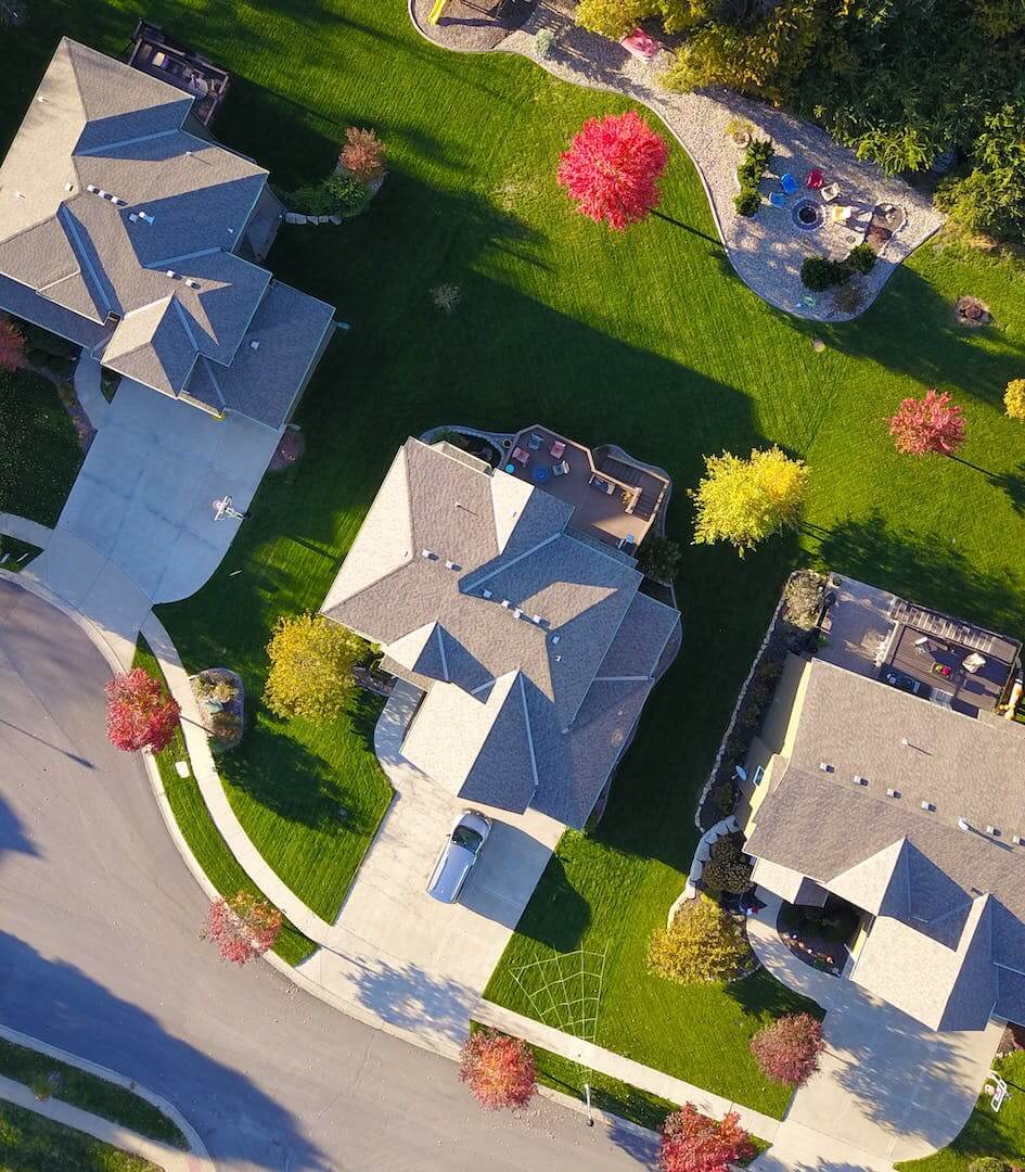
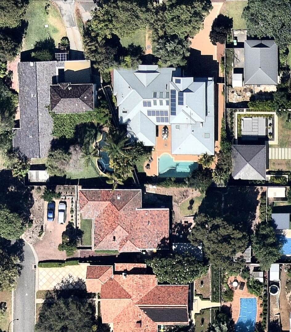
Site Analysis provides instant context with up-to-date, high resolution aerial photography and micro-climate analysis.
Choose your site location and size – readily available for most urban areas in Australia!
- Up-to-Date & High-Resolution
- Instant & No Subscription
- Georeferenced
- Customisable location and size
Site Analysis Features
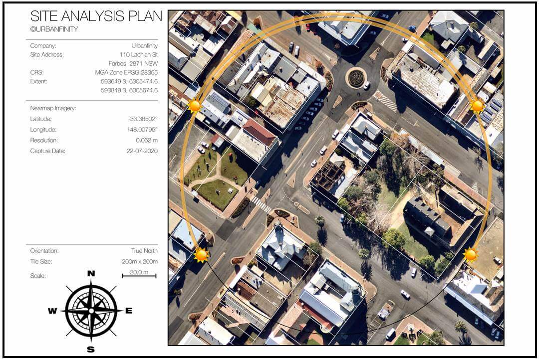
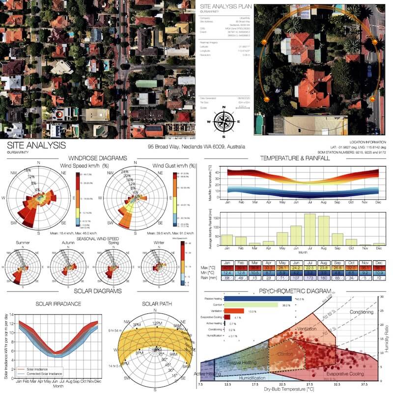
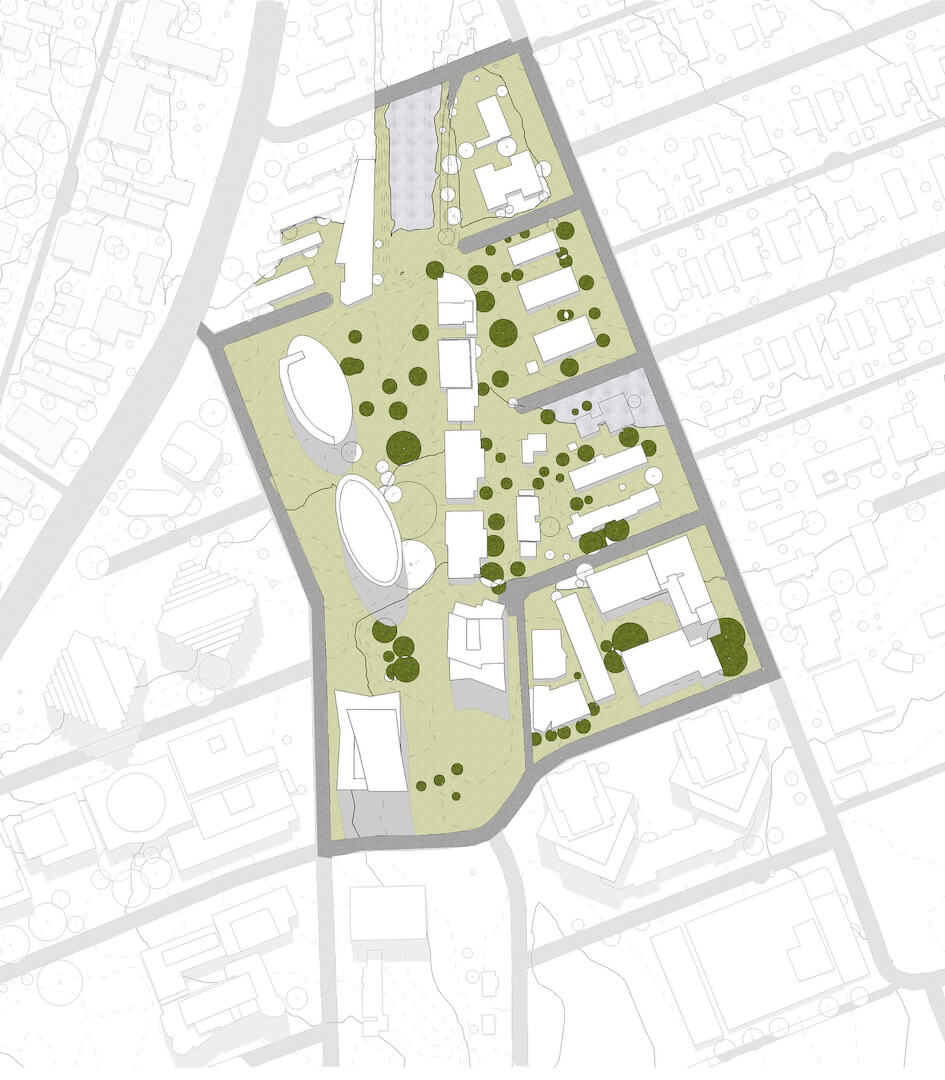
Site Plan
- Detailed view of real world context
- Sun swepth paths for Solar + Shading Analysis
- Referenced by exact date and geolocation
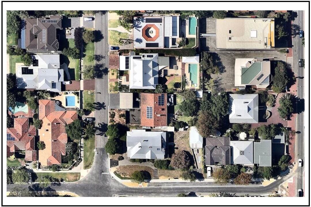
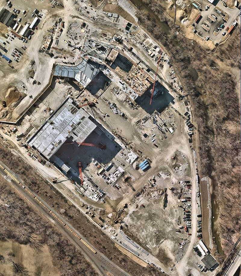
High Fidelity Aerial Imagery
- Reliable High Resolution (1.5cm to 2cm)
- Frequently Updated by MetroMap
- Ultra clarity and uniform orthorectified scale for high fidelity measurements
- Geo-tiff format for universal CAD/GIS import
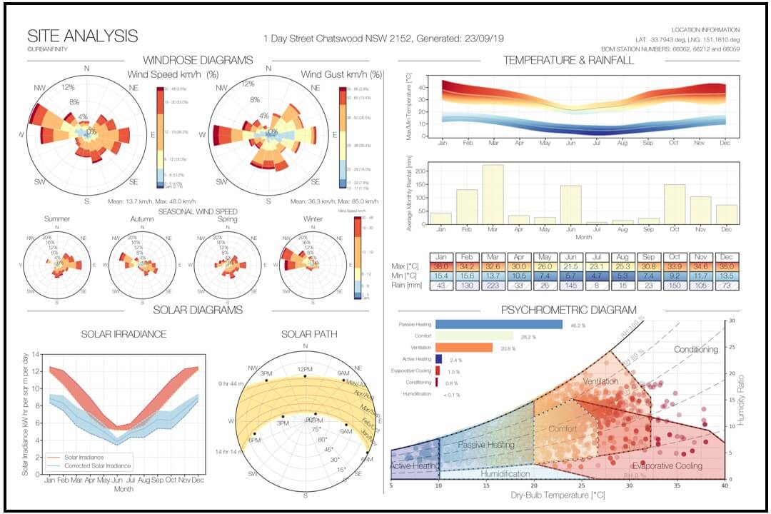
Site Climate Analysis
- Solar Analysis incl. Solar Paths, Irradiance, and Cloud Cover
- Windrose Speed + Gust
- Temperature + Rainfall
- Psychrometric Analysis for comfort design strategies
INDUSTRIES
From architecure to landscaping to solar roofs, Site Analysis power today's industry and community to bring accurate real world insight to your project.
Our Prices
Fixed prices, no subscription required. High resolution imagery and analysis at your fingertips in a few minutes.
From $50 for a 125m x 125m tile
up to 500m tile size (price will vary with size)
Site Analysis Order
Request instant Site Analysis for your site now
FAQs
Q1. What Is Site Analysis useful for?
Q2. What areas are covered and how often are the images updated?
Q3. What is the resolution and accuracy of the images?
Q4. What geo-reference system and orientation is used?
Q5. When can I expect the order and how will I receive it?
Q6. Can I preview the order?
Q7. What if I ordered by mistake?
Q8. What if I need a bigger size than 500m?
Q9. What if I'm unhappy with the order?
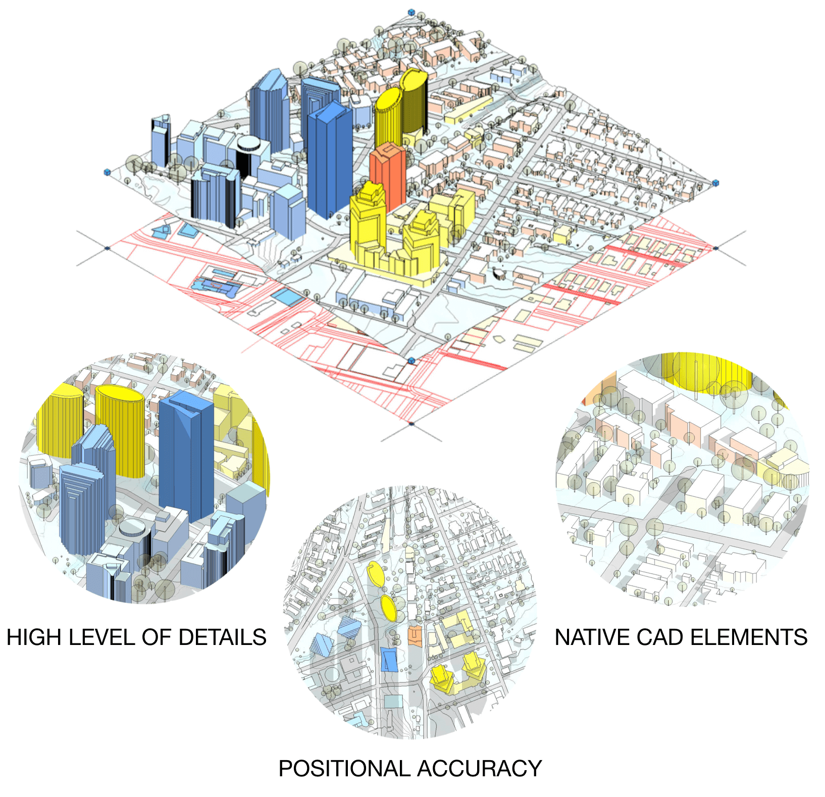
Need More? Go 3D and beyond with Context Map
Context Map by Urbanfinity is a new tool for Architects and Urban Planners to jumpstart with a suite of geospatial 3D CAD data - providing all real world information about a new site location directly into your favourite design platform (supporting Revit, ArchiCAD, AutoCAD and many more).
- Current & Contextual
- Real World 3D Features
- Georeferenced and Native CAD Format

Rapid, Intelligent Optimised Urban Development
Context Map and Site Analysis by Urbanfinity can achieve rapid, intelligent site analysis for optimised and sustainable urban development, providing a customisable 3D model and analysis for any new project site.