Skip to content
Urbanfinity Visual Impact Services

Visual Impact Assessments

We work with architects, developers, planning teams and neighbouring property owners to assess visual impacts and provide clear, independent documentation for planning and development applications across Australia.


Why Project Teams Choose
Urbanfinity Consulting

  • Architect-led assessment

  • Independent technical advice

  • Planning and development experience

  • Spatial and viewshed analysis capability

  • Clear, decision-ready reporting

  • Australia-wide project services

Send Us Your Project

service@urbanfinity.com.au or 1300 429 205


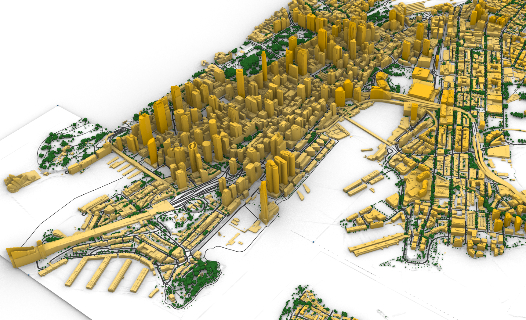
Sydney Rhino Merged City Model
Urbanfinity 3D context modelling — available Australia-wide.

Meet Stuart Jenkins - Visual Impact Specialist

I'm Stuart Jenkins, Visual Impact Specialist at Urbanfinity. I lead our Visual Impact team and bring more than 15 years of architectural experience across residential, multi-residential, commercial and hospitality projects in Australia,
the USA and London.

I hold a Bachelor of Science (Architecture) from the University of Sydney and a Bachelor of Architecture. If you're planning a project anywhere in Australia, send us your available documentation and our team can advise on the appropriate visual assessment approach.

For any questions please reach out to me at service@urbanfinity.com.au or call 1300 429 205.

Stuart Jenkins
Stuart JenkinsTechnical Team Leader

Visual impact is rarely determined by a single viewpoint. It requires an understanding of landscape, planning, design, and the way people experience places.

Our assessments bring these disciplines together to deliver practical, evidence-based reporting for development projects.

Whether you are supporting a planning application or responding to authority feedback, we provide independent advice that helps project teams make informed decisions with confidence.


1. Architect-led assessments
Our team understands how planning outcomes are influenced by design decisions, landscape context and the built environment—not just technical reporting.

2. Advanced spatial analysis capability
We can integrate advanced GIS, terrain modelling and viewshed analysis where projects require a higher level of visual assessment.

3. National project experience
We support residential, commercial, infrastructure and renewable energy projects across Australia, adapting each assessment to the planning framework and project context.

4. Independent, evidence-based advice
Our recommendations are based on planning context, site conditions and objective analysis, helping project teams respond confidently to approval requirements.

How We Analyse Visual Impact

Our assessment approach combines spatial analysis, architectural understanding and project-specific visual evidence.
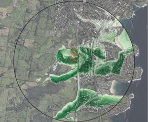
Viewshed Analysis
Viewshed Analysis

Identification of where a proposed development may be visible and to help establish relevant viewpoints for detailed assessment.
3D Modelling
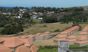
3D Modelling

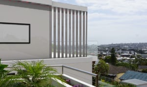
Our team will then place a proposed 3D architectural model into the existing landscape.
Spatial Analysis
Spatial Analysis

We integrate advanced GIS, terrain modelling and photomontage where projects require a higher level of visual assessment.

The Visual Impact Assessment Process

Step 1
INFORMATION
Share any available plans, site information, planning correspondence, photos or supporting project documentation.

Step 2
SCOPE CONFIRMED
Our team reviews the proposal, site context and approval requirements before confirming the appropriate methodology and deliverables.

Step 3
ASSESSMENT
We examine visibility, key viewpoints, landscape character and the relationship between the proposal and its surrounding context.

Step 4
REPORT
You receive clear, project-specific documentation prepared to support planning review, design decisions or authority responses.

A Clear Assessment of Your Project’s Visual Impact

Rather than navigating planning requirements on your own, you’ll receive an assessment tailored to your project, its surroundings and the relevant approval pathway. The scope and deliverables are then shaped around your site’s characteristics, planning context and the specific requirements of the relevant authority.
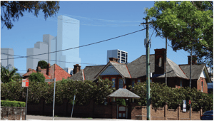
Visual Impact Assessment Example
An Independent Visual Impact Assessment

A professionally prepared assessment describing the project's visual effects within its surrounding landscape and built environment.
A project-specific assessment methodology
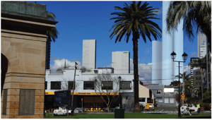
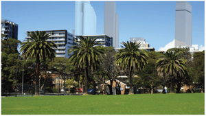
Assessment criteria, viewpoints and reporting scope are selected to suit the planning context rather than using a one-size-fits-all approach.
Visual Impact Assessment City Example 1
Visual Impact Assessment City Example 2
Documentation for Planning Submissions

Reporting prepared to support development applications, environmental assessments or responses to requests for further information.
Practical suggestions where appropriate
Where relevant, we identify opportunities to reduce visual impacts through siting, design refinement, materials or landscape responses.
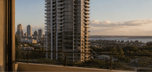
IMAGE02-MEREWETHER
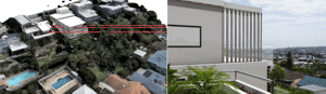
Image from recent Urbanfinity Visual Impact Assessment Report.

Visual Impact Assessment FAQs


What is a Visual Impact Assessment?


A Visual Impact Assessment (VIA) is an analysis of potential visual impacts to the landscape or existing built fabric which may arise from a proposed development or land management action. The assessment aids in understanding the effects of a proposed development (whether positive or negative) on the surrounding context and as such may be included as part of an Environmental Impact Assessment or completed independently. A Visual Impact Assessment helps define the visual effects of a project on people’s everyday views by considering the built, natural and cultural character or sense of place.

When is a Visual Impact Assessment required?

Requirements vary between councils, planning authorities and project types. Visual Impact Assessments are commonly requested for developments that may affect surrounding landscapes, scenic values, neighbouring properties or important public viewpoints.

What information do you need to prepare an assessment?

We typically require available architectural drawings, site plans, survey information, planning correspondence and any relevant authority requirements. If you don't have everything yet, send what you have and we'll advise what else may be needed.

Do you undertake site inspections?

Yes, where appropriate. The need for a site inspection depends on the project, available information and planning requirements. We'll recommend the most suitable approach during our initial project review.

Can you include viewshed or GIS analysis?

Yes, where appropriate. Assessments can incorporate advanced spatial analysis, including viewshed modelling and GIS-based assessment techniques, depending on the project's complexity and planning requirements.

Can a Visual Impact Assessment help improve the design?

Yes. An assessment at any stage of your project can identify opportunities to refine siting, building form, materials, landscaping or screening before planning submissions are finalised.

How do I get started? 

Simply send us your available plans, site information or planning documentation. We'll review your project, confirm the appropriate assessment scope, provide a fixed quotation and explain the next steps. You can also email us at service@urbanfinity.com.au with any questions.