
Skip to content

Viewshed Analysis

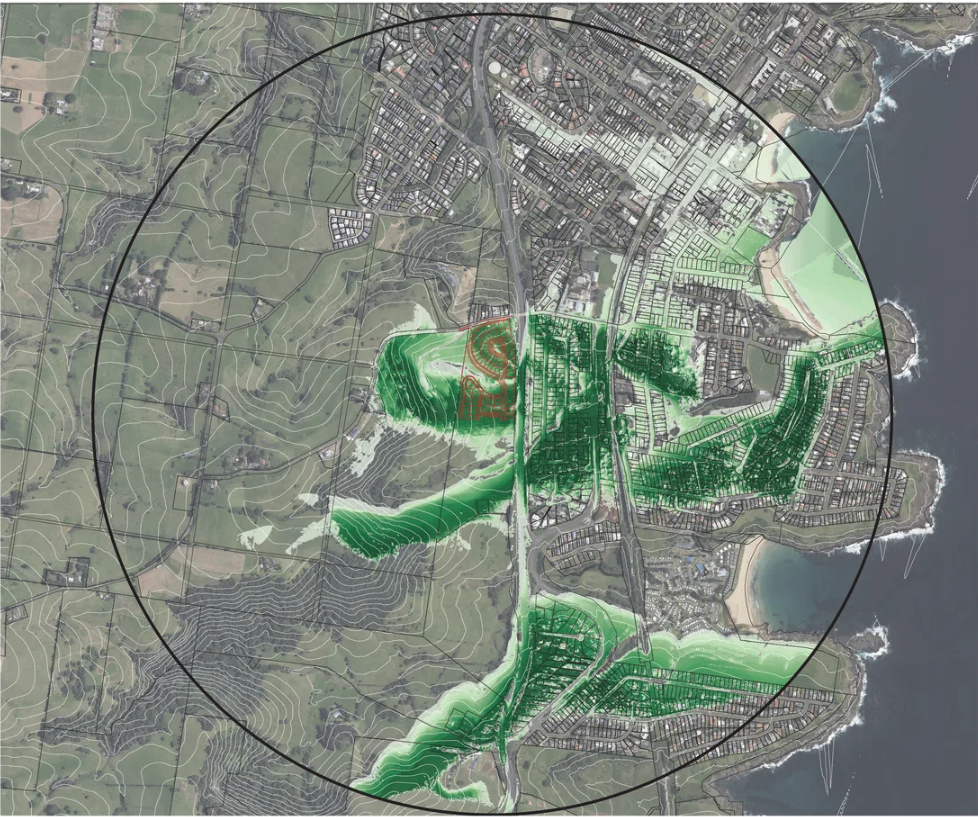
A 3D and GIS-based analysis that identifies areas and viewpoints from which a proposed development may be visible. 

What is a Viewshed Analysis?

Viewshed Analysis is a GIS-based technique used to identify where a proposed development may be visible across the surrounding landscape. Using terrain data and line-of-sight modelling, it provides clear evidence to support design and planning assessment.

It is particularly useful for elevated sites, complex terrain and developments where visibility from roads, public spaces, neighbouring properties or key viewpoints may influence planning outcomes.

A Viewshed Analysis focuses on where a development can be seen, rather than assessing the significance or acceptability of that visibility.


Contact Us

service@urbanfinity.com.au or 1300 429 205


What is a Visual Analysis Used For?

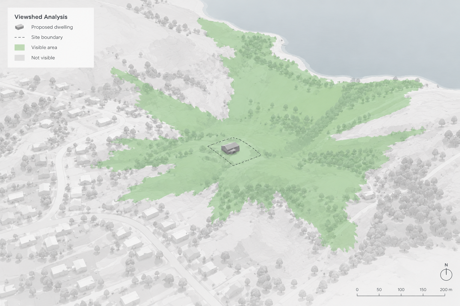
Viewshed Analysis Birds Eye

Elevated or Exposed Sites

 Projects located on hills, ridgelines, slopes or other elevated areas can have a broader visual presence. Viewshed Analysis helps identify the areas that may have visibility of the proposed development.  

Coastal, Rural or Scenic Settings

With fewer buildings, trees and other obstructions, open and scenic environments can offer long-range views. Visibility modelling can help establish the potential viewing area across these landscapes.

Public and Sensitive Viewpoints

Key locations such as roads, parks, lookouts, waterways and walking trails may require specific consideration. Viewshed Analysis can identify whether the development is potentially visible from these viewpoints. 

Upper Levels or Prominent Roof Forms

Elements extending above the surrounding built form — including upper floors, roof structures, plant equipment and towers — can create additional visual exposure. Mapping can show where these elements may become visible. 

Council or Planning Queries

 When visibility or sightline concerns are raised during the planning process, a Viewshed Analysis can provide clear spatial information to help investigate and respond to those questions. 

Early Design Testing

Viewshed analysis can be used during the design process to test different building heights, locations, massing, roof forms or screening options. This allows potential changes in visibility to be considered before the design is finalised. 

Step 1

Establish the Site and Development

First, the project site, terrain and key development components are defined. This may include the proposed building envelope, upper levels, roof structures, towers or other elements being assessed.

Step 2

Build the Spatial Model

Relevant terrain, topographic and surrounding context data are incorporated into the GIS model. Where required, assumptions around existing buildings, vegetation, observer height and screening are also established.

Step 3

Identify Key Viewing Locations

Potential observer locations are selected based on the planning context. These may include surrounding roads, public spaces, reserves, lookouts, waterways, neighbouring streets and other relevant viewpoints.


Step 4

Model Visibility

The analysis tests potential lines of sight between the selected observer locations and the proposed development. It determines where the development may be visible and where terrain or other modeled features could restrict views.

Step 5

Present the Results

The findings are presented through visibility maps, viewpoint analysis and documented modelling assumptions. These outputs provide a clear picture of the proposal's potential visual exposure and can help identify where further assessment may be required.
Viewshed Analysis 2


Why is Visibility an Important Consideration?

What Influences Visibility

  • Terrain: Hills, ridgelines, valleys and slopes can either block or increase visibility.
  • Observer locations: Roads, reserves, walking tracks, waterways, public spaces and surrounding properties may provide views toward the development.
  • Landscape openness: Open rural, coastal and undeveloped areas generally allow views over greater distances than dense urban areas.

Surrounding Context

Existing buildings, structures and vegetation can screen or partially obscure a proposed development. The surrounding urban form, landscape character and available screening are therefore considered when assessing potential visibility.

What May Be Visible

Visibility may be limited to certain parts of a development, such as roof forms, upper storeys, rooftop plant or other elevated elements. The analysis considers these elements alongside terrain, existing development and vegetation to identify where the proposal may be visible across the surrounding area.
Viewshed Analysis Suburban Map

Our Clients Love Us

See what our clients have to say about us.

Had good definition, good level of detail, with a good split into sub-categories.” 3D Data “Buildings are good block models, ie no mesh faces.

Anthony BowdenBIM Manager of SMART DESIGN STUDIO
My first thought is that is a very useful tool to quickly get a base to work from. We often spend too much time trying to generate this by hand while still being pretty inaccurate.” “it’s really useful to see a 3d representation of an unknown area so quickly.
Rido PinDirector of Plus Architecture
This product was able to be supplied to me in native CAD REVIT format, will definitely use again for future projects.
Blake ThompsonThrum Architects